Lyngby-Tårbæk Kommune (Lyngby-Tårbæk Kommune)
The municipality covers an area of 39 km², and has a population of 56,614 (2021). Its mayor is Sofia Osmani, a member of the Conservative People's Party. The main town and the site of its municipal council is the town of Kongens Lyngby.
Lyngby-Taarbæk Municipality was not merged with any other municipality in the municipal reform of 2007.
In the Middle Ages, when Denmark was divided into syssels, Lyngby-Taarbæk was part of Østersyssel. It later became a part of Copenhagen Fief, which was changed to Copenhagen County in 1661. Although Copenhagen County changed many times over the years, Lyngby-Taarbæk always remained within the borders. When the counties were disestablished in 2007, Lyngby-Taarbæk came under the new Capital Region of Denmark.
Since 1842, and until the 1970 Danish Municipal Reform, Lyngby-Taarbæk was a parish municipality. It became a regular municipality with the 1970 reform, and its borders have remained unchanged since. Lyngby-Taarbæk wasn't merged with any other municipality in the 2007 municipal reform.
Map - Lyngby-Tårbæk Kommune (Lyngby-Tårbæk Kommune)
Map


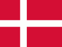
Country - Denmark
 |
 |
| Flag of Denmark | |
As of 2013, the Kingdom of Denmark, including the Faroe Islands and Greenland, has a total of 1,419 islands above 100 m2; 443 of which have been named and of which 78 are inhabited. Spanning a total area of 42943 km2, metropolitan Denmark consists of the northern part of the Jutland peninsula and an archipelago of 406 islands. Of these, the most populated island is Zealand, on which the capital Copenhagen is situated, followed by Funen, the North Jutlandic Island, and Amager. Denmark's geography is characterised by flat, arable land, sandy coasts, low elevation, and a temperate climate. As of 2022, it had a population of 5.928 million (1 October 2022), of which 800,000 live in the capital and largest city, Copenhagen. Denmark exercises hegemonic influence in the Danish Realm, devolving powers to handle internal affairs. Home rule was established in the Faroe Islands in 1948 and in Greenland in 1979; the latter obtained further autonomy in 2009.
Currency / Language
| ISO | Currency | Symbol | Significant figures |
|---|---|---|---|
| DKK | Danish krone | kr | 2 |
| ISO | Language |
|---|---|
| DA | Danish language |
| EN | English language |
| FO | Faroese language |
| DE | German language |